Iceland time
2014.12.17. 06:26
Iceland time
2014.12.17. 06:26
Iceland time
2014.12.17. 06:26
Iceland time
2014.12.17. 06:26

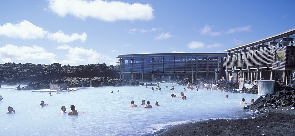
Meet & Greet at Keflavík airport with our driver and guide. After just 20 minutes drive we will experience one of the most unusual welcome to any country. We put on our swimming costumes and go bathing in the Blue Lagoon, a natural mineral-rich geothermal pool in the middle of a large and dramatic lava field, reputed for its healing properties. It is special and invigorating. After the bath we will continue our trip to Reykjavik. During the 45 minutes drive the guide will tell you about Iceland and give you a few practical information’s. Arrived in Reykjavik we will check in at our hotel for one night.
We drive along the shores of the scenic Hvalfjörður Fjord, stopping at the traditional and famous wool factory of Álafoss for a little factory outlet shopping offering best Icelandic woollen products and different handicrafts of local artists. We are passing the old extinct whaling station before we reach the peaceful farming district and valley of Borgarfjörður, the setting of Egil’s Saga, framed by mountains and glaciers that are backdrops to many of the best salmon rivers in Iceland. We go to Grábrók volcano, a 3000 years old crater surrounded by a nicely moss covered lava field – possible to walk up to the rim of the crater (20 min) for a splendid view over the lava field and its region. Next stop is the Deildartunguhver, one of the world’s biggest hot springs. We explore a multitude of natural springs under a birch covered lava field, which creates a waterfall of hundreds of meters wide, the magnificent Hraunfossar (Lava Falls) seemingly appearing out of nowhere across the bank. A 10 minutes walk up the river is the Barnafoss (Children’s Fall), which has carved out strange figures from the rock. We continue to historic Reykholt, where Snorri Sturluson lived, a brilliant 13th-century.
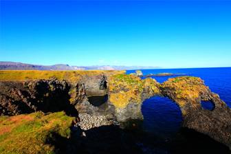
Today we drive to the Snæfellsnes peninsula with its national park and the dominating Snæfellsjökull glacier. The glacier is famous for the setting of the novel “Journey to the Center of the Earth” by the French author Jules Verne. According to him the entrance to the underworld lies at this glacier. The peninsula is often called Iceland in miniature because many national sights can be found in this area. We visit small fishing towns, drive through lava fields and enjoy the coastal scene. The Snaefellsnes Community is a so called green community and has recently become the first Green Globe Certified Community in Iceland & Europe and only the 4th in the world.

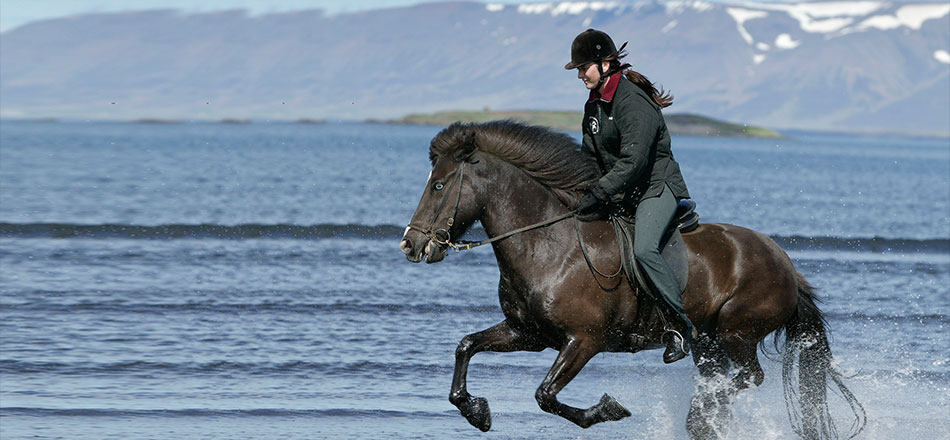
From Reykholt we drive via Holtavörðuheiði to the north of Iceland. We drive pass Vatnsdalshólar, a cluster of hills of all sizes across the mouth of Vatnsdalur valley. These hills are considered to be one of the three “innumerable” things in Iceland along with the lakes in Arnarvatnsheiði and the islands on Breiðarfjörður. We are now in Skagafjörður one of Iceland's most prosperous agricultural regions and especially known for horse breeding and therefore called “valley of horses”. We continue to the town of Dalvík by Eyjafjörður Bay, the longest bay in Iceland for two nights.

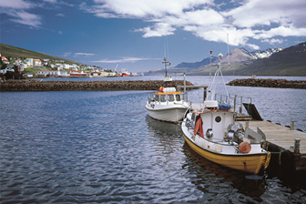
Today we will take the ferry to Hrísey, the second largest island of the country but with only a population of app. 200 people. Hrísey has developed a reputation as a bird watching destination. There are no natural predators on the island, which makes the island an ideal bird sanctuary. We take a 40 minute tractor trip around the village and surroundings, on a hay cart towed by an e http://www.gjtravel.is/media/w700/ed3bca784aa1492.jpglderly tractor before heading back to the main land. After the visit to Hrísey we drive to the villages Ólafsfjörður and trough the new tunnel Héðinsfjörður Tunnel to Sigluförður. Siglufjörður was called the world capital of the herring fisheries in the sixties. Since the herring diminished the inhabitants concentrate on the old stocks and fishing and fish processing are still the main trades. We enjoy the magnificent mountains and beautiful nature before heading back to our accommodation in Dalvík.

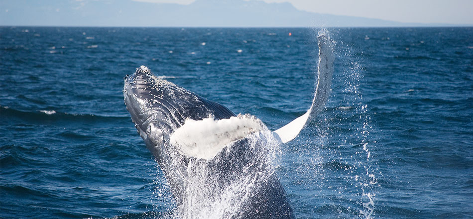
Today we drive to Akureyri, Iceland's second largest urban area after the Greater Reykjavík area and and often called „the capital of the north”. It boasts of a thriving cultural life, museums, a http://www.gjtravel.is/media/w700/57598b82b56665f5.jpgcollege, a university and other schools. We will enjoy a city tour before heading to the village Húsavík, where we will stay for three nights. On our way we will visit Goðafoss waterfall. Not only is Goðafoss a stunning waterfall, but it has also played an important role in the history of the country in connection with the introduction of Christianity. The first organized whale watching tours in Iceland started from Húsavík in 1995 and ever since the number of visitors coming to observe these majestic creatures has grown from year to year. The bay of Skjálfandi seems to provide prime conditions for whales. Most common are humpback whales, minke whales, white beaked dolphins and harbour porpoises. Enjoy an afternoon at leisure in this picturesque village and go an optional whale watching tour, visit one of the museums or just sit back and relax.

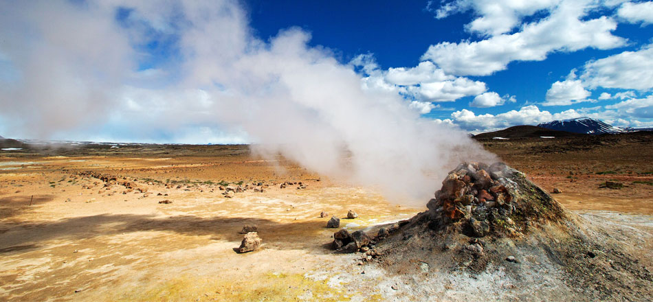
We will spend all day at Lake Mývatn, a unique area that features strange lava formations, attractive bays, pseudo craters and thousands of birds. Skútustaðargígar where we find numerous pseudo-craters formed over two thousand years ago during one of many eruptions in this area.We stop at Dimmuborgir, Dark Castles, where towering lava formations characterize the surrounding landscape and Námaskarð (mine passage)at a bright colorful mountain where sulphur was once mined from a geothermal zone and where many boiling mud pots are to be found with that special smell of the devils-cuisine. Mývatn area is a paradise for birds, especially ducks which are all to be found breeding in the Lake Mývatn area. During the nesting period however areas around the lake are closed for human access but we will try during our stops to spot some of these numerous birds on our way back to our accommodation.

We visit the high sea cliffs of Tjörnes peninsula which is rich in bird life and from where on a good day the island Grímsey can be seen. It is the only place in Iceland, which reaches the arctic line. Onward we drive to Hljóðaklettar, a place with strange rock formations. We visit the canyon of Ásbyrgi, a puzzling place said to be a hoof print of the eight-legged horse of the ancient God Óðinn. Ásbyrgi is part of the national park Jökulsárgljúfur and we continue through bare and deserted landscape to visit yet another site in the park the spectacular Dettifoss (the falling waterfall). It is the most powerful waterfall in Europe falling 44 meters into the magnificent canyon of the Glacial River, with on average 195m3/sek. After we have seen this magnificent waterfall we will return to our accommodation in Húsavík.
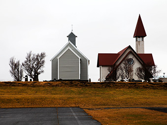
Today we will travel through the east part of Iceland, through bare and sometimes deserted landscape with mountains all around. On the way we will make at least one stop at Möðrudalur, the all-year residence at the highest altitude in Iceland, 469m above sea level. In summertime they run a service centre there, a great place to halt enjoy the view of the queen of Icelandic mountains and visit the church at the farm – home made 1944 by the former farmer in the memory of his late wife. On we go through more fascinated bare landscape also going along the long valley of Jökuldalur (glacial valley) reaching the fertile region of Fljótsdalshérað and onward to south of Iceland, driving on road nr. 1 through green valleys, over mountain roads, along the coast line arriving in Berufjörður, one of many fjords of the east. We drive all around it arriving in the small fishing village Djúpivogur for a short visit before we end our day near Höfn and check in for one night.

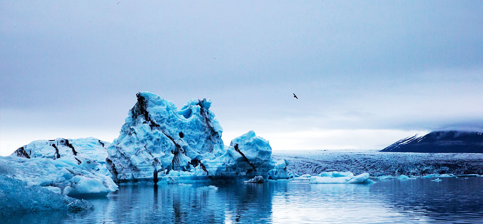
Vatnajökull, Europe´s biggest glacier dominates the landscape. If the weather permits we will be able to enjoy the view of many glacier tongues descending its main ice cap – an amazing contrast to the green fertile areas we drive through. We stop at the glacier lagoon, Jökulsárlón, embark a boat and sail around the floating icebergs of the lagoon. After the boat trip we continue our journey along the south coast with Vatnajökull and also the highest peak in Iceland, 2119m on our right. We will stay for the next two nights in Skaftafell National Park.
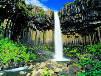
The day will be spent walking in the Skaftafell national park, one of Iceland’s national parks since 1967. The park offers big contrasts in landscape with glaciers, moors, mountains, birch forest, glacial rivers and brooks and sandy plains (the flood of 1996 that temporarily cut road nr. 1 passed next to the national park and from a sight seeing point that area can be seen). There are several walking possibilities and the most frequent one is to walk up to Svartifoss (black waterfall) with its nice formations of basalt columns. From there head on to Sjónarsker (view point), from were the area of the flood of 1996 and the highest peak of Iceland can be seen. Returning and on the way passing by the old turf farm at Skaftafell.

We leave Skaftafell driving over Skeiðarársandur, where the flood of 1996 temporarily cut of this road and some of its bridges, leaving iceberg scattered around the sandy plains and we continue driving through the lava fields of Eldhraun (fire lav) resulted from a yearlong eruption in 1783. This eruption was devastating for Iceland, and the years that followed are referred to as the “misty times” due to the volcanic ash lingering for along time in the air. Passing through the small village of Kirkjubæjarklaustur and driving through the black sands of Mýrdalssandur before http://www.gjtravel.is/media/w700/b84a61838aa91348.JPGarriving in the village of Vík. On we go arriving in Skógar, a tiny village where one of the better Folk Museum can be found with a turf house in the garden and couple of old wooden houses to visit. After we visit the museum we head on to the waterfall of Skógar, falling gracefully 60m down the green mountain, a waterfall used more than once as a motive in advertisement. On we go making our last stop at another waterfall called Seljalandsfoss, falling narrowly 50m, possible to see from all sides as we can walk behind it – with care and with the risk of getting wet! From there we drive again through the biggest agricultural area in Iceland, the south low land, here we stay for one night.
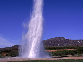
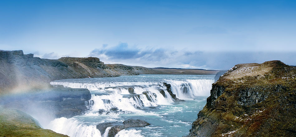
Today we will drive on to Gullfoss which is known in Iceland as the Queen of Icelandic waterfalls and meaning “Golden Falls” , The water falls 32 meters into the canyon of Hvítá (the white river) after having travelled 30 km from the glacier Langjökull (the long glacier) in the north. Nearby is the fascinating geothermal area of Geysir. The most active geyser is Strokkur “the churn” which can spout up to seventy feet every five to seven minutes. Driving on through the agricultural area of the south, passing the small village of Laugarvatn to drive over a mountain road only used in summer and reach the national park of Þingvellir. It is the most important historical place of Iceland, the old parliament site, where in the year 930 ac. the national assembly was founded to rule the country. We will take short walk through the old sites trying to find the atmosphere of long gone times. Þingvellir is not only important for Icelandic history, but also it is a place of high geological interest, a place where the meeting of the two drifting continental plates can be seen. We leave Þingvellir and head back to Reykjavík for one last night.

Unfortunately it is time to say goodbye. You will be picked up by a driver and brought to Keflavík International Airport for your departure flight.
CONTACT US | E-mail©2014 ICELANDTRAVEL.COM.CN All Rights Reseved.

WEBCHAT